

You must log in or register to comment.
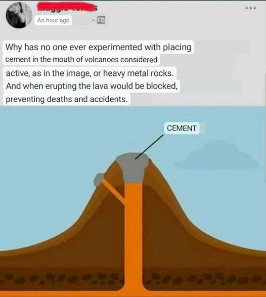
This requires a lot of concrete. A more economical solution would be to just move the volcano elsewhere. Plus then you can sell all of the new real estate where the volcano once stood!
Big volcanoes look like this

(Mount Rainier, Washington)
The BIGGEST volcanoes look like this

Or this
Notice how they don’t have that nice big pretty volcano cone shape? It just looks like some drunk geologists scribbled on a map and drew circles around a low lying area with a lake or two in it and called it a “volcano” or a “volcanic zone”.
The reason though is that the BIGGEST and most destructive volcanic eruptions tend to happen with lava/magma that doesn’t flow very well and like when you get a stuffed nose, everything gets blocked up. Like many of us, these volcanos don’t solve the problem and go take a decongestant or blow their nose, they just sit there sniveling and stewing, failing to release the pressure that keeps building and building and building.
These eruptions are called felsic eruptions (the opposite of mafic, goopy eruptions you have seen footage of from Hawaii where the lava comes out like a fluid). An immense amount of gas is released by magma as it becomes exposed to the surface (which then we call it “lava”) as the gas is no longer kept in the magma at immense pressures. The magma can’t flow and “pass the gas” so to speak so a plug forms and what you get is a terrifyingly big pressure cooker that just builds and builds like that person on the plane next to you that just keeps sniffing and sniffing and never blowing their nose.
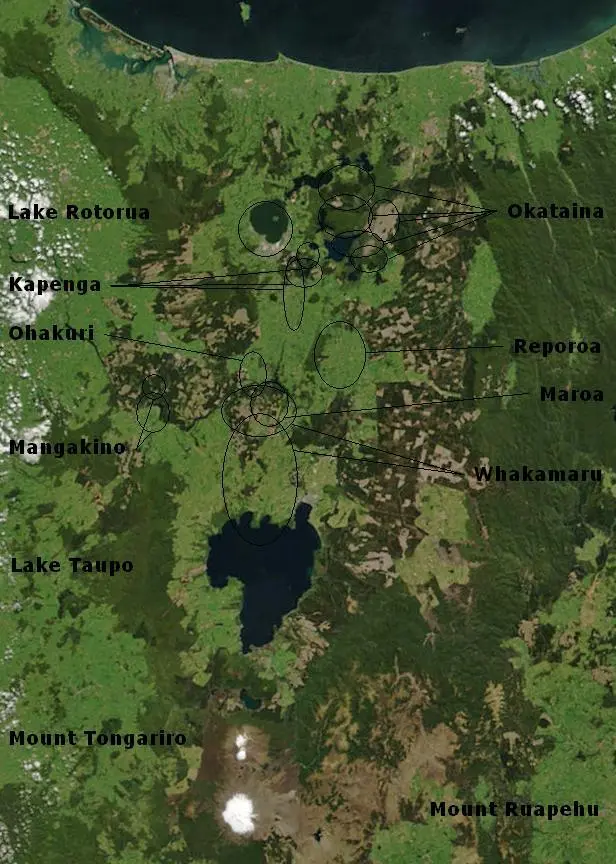
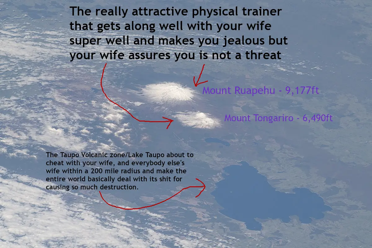
When the built up pressure finally overcomes the plug, the resulting explosion is so catastrophic it doesn’t leave a clean volcano shape. What you are left with is an uneven low topography dotted with lakes that marks the site of an incomprehensibly large explosion, hence the topography of Yellowstone, Wyoming and the Taupo Volcanic Zone on the North Island of New Zealand.
TIME FOR SOME STATS THAT WILL BREAK YOUR BRAIN
"The Taupō Volcanic Zone has produced in the last 350,000 years over 3,900 cubic kilometres (940 cu mi) material, more than anywhere else on Earth, from over 300 silicic eruptions [my edit: “Felsic” means “has lots of silica/silicic (silicic? seriously wikipedia?) and wants to form minerals high in silica like quartz and feldspar”], with 12 of these eruptions being caldera-forming. Detailed stratigraphy in the zone is only available from the Ōkataina Rotoiti eruption but including this event, the zone has been more productive than any other rhyolite predominant volcanic area [my edit: Rhyolite is a record of catastrophe, it is a Felsic, silica-rich igneous rock like Granite except it cooled FAST at the surface instead of in big underground “batholiths” (that make up a good portion of the Canadian Shield and the NE of the US among other places) where the minerals had time to grow into big pretty crystals, same ingredients as Granite but with much more exciting baking instructions] over the last 50,000 odd years at 12.8 km3 (3.1 cu mi) per thousand years. Comparison of large events in the Taupō volcanic zone over the last 1.6 million years at 3.8 km3 (0.91 cu mi) per thousand years versus with Yellowstone Caldera’s 2.1 million year productivity at 3.0 km3 (0.72 cu mi) per thousand years favours Taupo…
…The last major eruption from Lake Taupō, the Hatepe eruption, occurred in 232 CE. It is believed to have first emptied the lake, then followed that feat with a pyroclastic flow that covered about 20,000 km2 (7,700 sq mi) of land with volcanic ash. A total of 120 km3 (29 cu mi) of material expressed as dense-rock equivalent (DRE) is believed to have been ejected, and over 30 km3 (7.2 cu mi) of material is estimated to have been ejected in just a few minutes."…
^https://en.wikipedia.org/wiki/Taupō_Volcanic_Zone
…“The main extremely violent pyroclastic flow travelled at close to the speed of sound and devastated the surrounding area, climbing over 1,500 m (4,900 ft) to overtop the nearby Kaimanawa Ranges and Mount Tongariro, and covering the land within 80 km (50 mi) with ignimbrite [my edit: the name for pyroclastic flow deposits, i.e. pumice and ash, that kind of thing]. Only Ruapehu was high enough to divert the flow. The power of the pyroclastic flow was so strong that in some places it eroded more material off the ground surface than it replaced with ignimbrite. There is evidence that it occurred on an autumn afternoon and its energy release was about 150 megatons of TNT equivalent. The eruption column penetrated the stratosphere as revealed by deposits in ice core samples in Greenland and Antarctica.”
^https://en.wikipedia.org/wiki/Taupō_Volcanic_Zone
why the did I make this stupid meme in feet instead of metric, I am such an asshole -facepalm
“Success! We have plugged the volcano!”
two days later

Where is this from?? Is this AI?
I believe that’s Mt St Helens erupting. Real footage from 1980 (though this gif is sped up).
If I recall correctly, it is not real “footage” but real photos which are interpolated into a film using editing software
That would definitely explain why it’s sped up if the source was a bunch of still images. I’ve seen other edits of it that look a little more like a real-time video.


